Satellite imagery reveals just how dramatically our city has grown — from a coastal city of around 3 million in the 1970s to a sprawling megacity of over 21 million today.
🚀 A city expanding at unprecedented speed
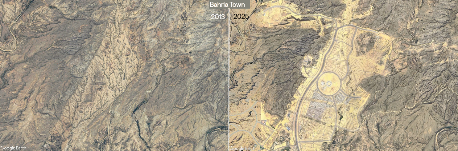
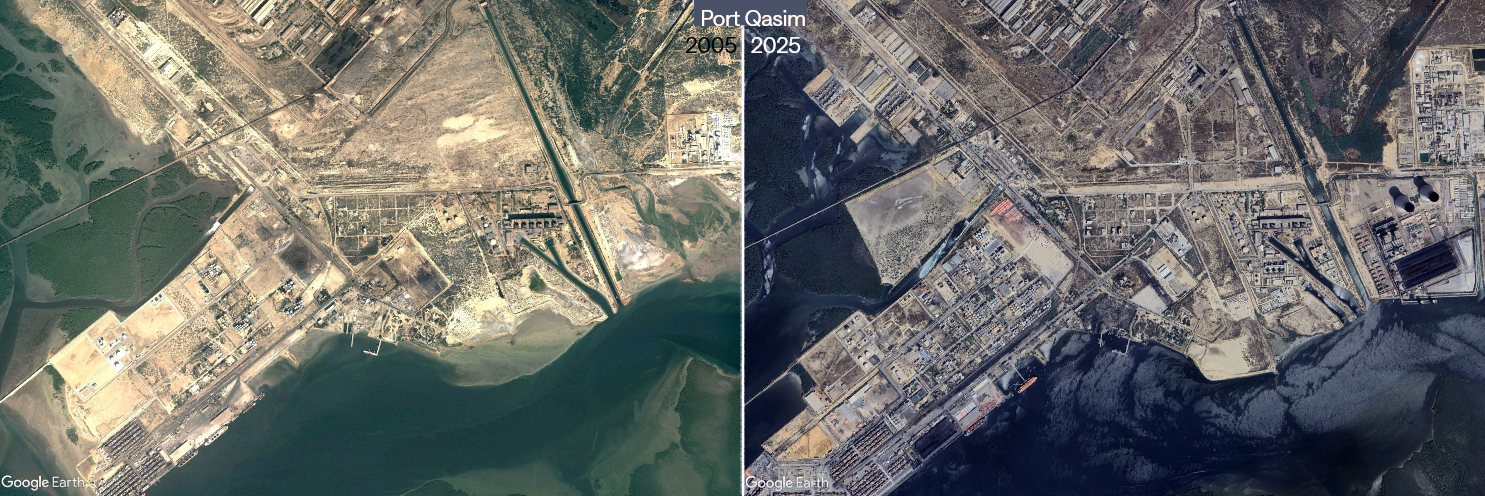
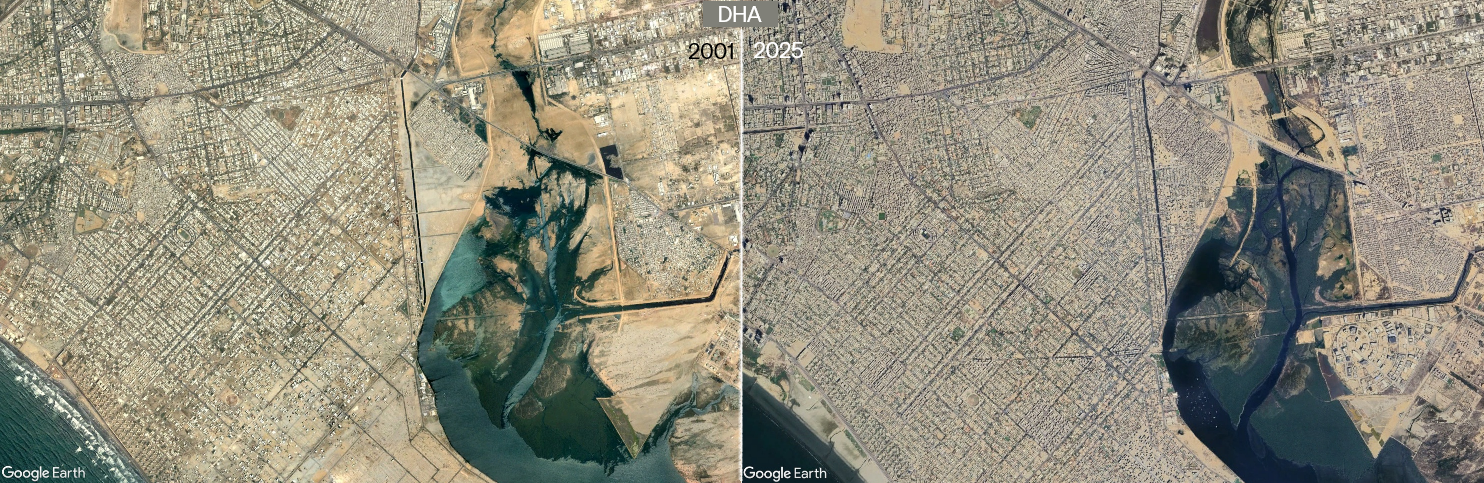
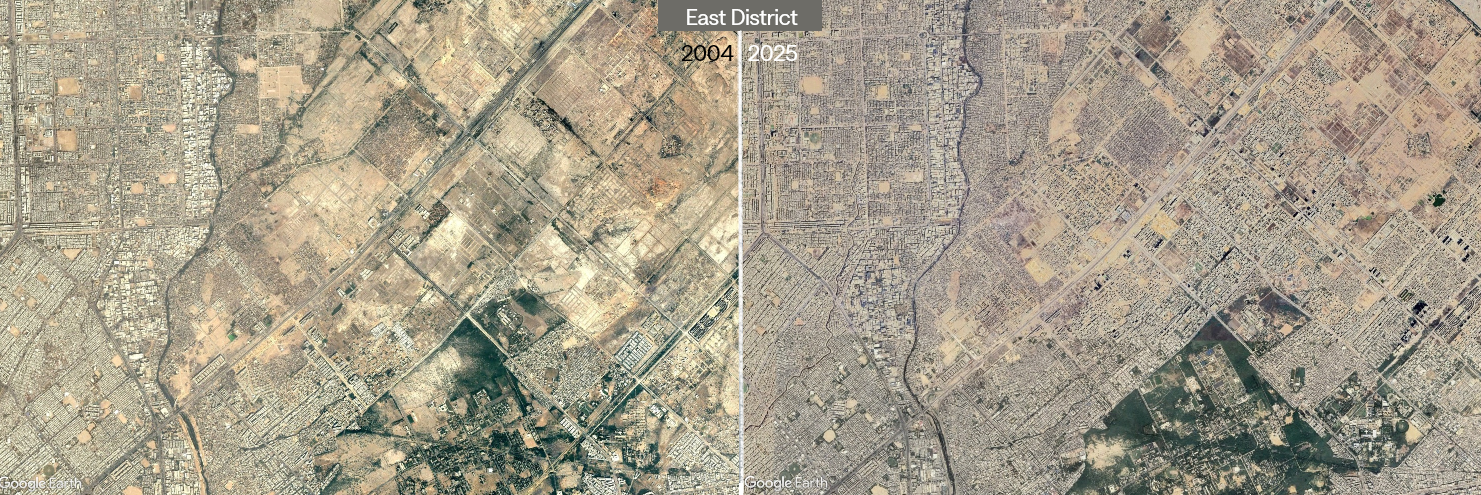
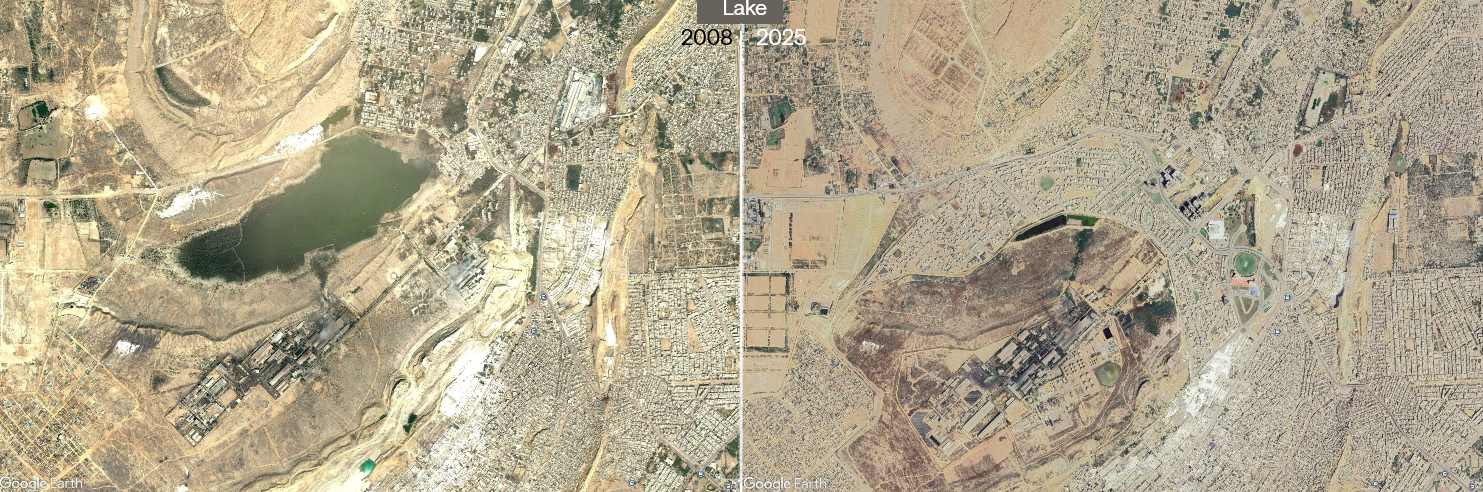
These images capture the physical evidence of Karachi’s extraordinary transformation:
- Urban sprawl: Agricultural land and open spaces replaced by dense residential neighbourhoods, industrial zones, and commercial centres.
- Coastal development: A reshaped shoreline — land reclamation, port expansion, and kilometres of new waterfront development.
- Infrastructure networks: Highways and expressways now linking once-distant areas to the urban core.
- Northern expansion: Housing schemes pushing the city’s boundaries outward year after year.
🧭 Understanding the past to plan the future
These are not just historic images — they are planning tools. They help us recognise:
✅ What worked: planned developments, supporting infrastructure, green corridors, accessible transport.
❌ What didn’t: uncontrolled sprawl, overstretched services, loss of agricultural land and ecosystems, informal settlements without basic needs.
🌍 From sprawl to strategy
The transformation visible from space reminds us: the decisions we make today will be visible from satellites in 2047.
🧐 Spot the transformation!
Are there other areas in Karachi you’ve seen change dramatically in just a few years? What should we take away from the rapid changes happening in our city? Looking at these satellite images, what lessons do you believe we need to learn for the future?
Share your thoughts in the comments section!